Area details
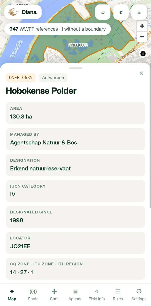
Tap an area, a dot or a spot on the map. A panel slides up from the bottom with everything Diana knows about that reference. Diana shows only what it really knows: never an empty box.
What is in the panel
Section titled “What is in the panel”For an area with a boundary:
- Reference, region and name.
- What the area file carries: area in hectares, managed by, designation, IUCN category, designated since. Not every reserve has all of these; that is a gap in the source data, not something Diana hides.
- The QSO count and last activation, from the WWFF directory.
- The locator, CQ zone, ITU zone and ITU region.
- More info: the reserve’s website, when the WWFF directory has one. It opens in your browser, so Diana and the map stay where they were.
For a reference without a boundary (dashed ring): the same panel without the area figures, and a note that Diana cannot tell whether you are inside it.
For a blue dot in another country: reference, country and name, locator and zones, From you (bearing and distance), the QSO count or ATNO in red when it was never activated, and More info.
Spot or announce from the panel
Section titled “Spot or announce from the panel”At the bottom of every panel are two buttons:
- Spot yourself here opens the spot form with the reference already filled in. See Spot yourself.
- Announce an activation opens the agenda form with the reference filled in. See Announce an activation.
Closing the panel
Section titled “Closing the panel”Swipe the panel down, or tap ×. The map stays where it is. On a phone, one bottom panel is visible at a time.